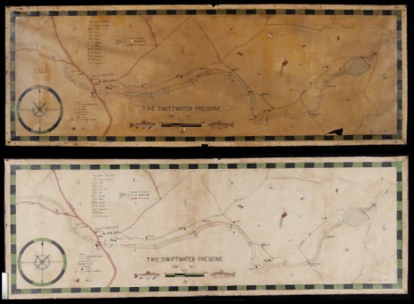
Treatment FOCUS: Map of the Swiftwater Preserve
Trout-fishing enthusiasts from Philadelphia founded the Swiftwater Preserve fly-fishing club in 1896, and in the 115 years since, Preserve members have been fishing the same stretch of stream that the founders fished in the Pocono Mountains of Pennsylvania. A map of this area, drawn by member Craige L. Reeves in 1938, hung in the Swiftwater Inn, the Preserve’s original base, until about 10 years ago, when the Inn returned the map to the Preserve to hang in their new clubhouse.
After over 60 years of display, the map showed signs of deterioration. “The paper had become brittle, and we had noticed some losses,” said Scott Stephenson, the Preserve member who recently brought the map to CCAHA for treatment. “We wanted to ensure its long-term preservation.”
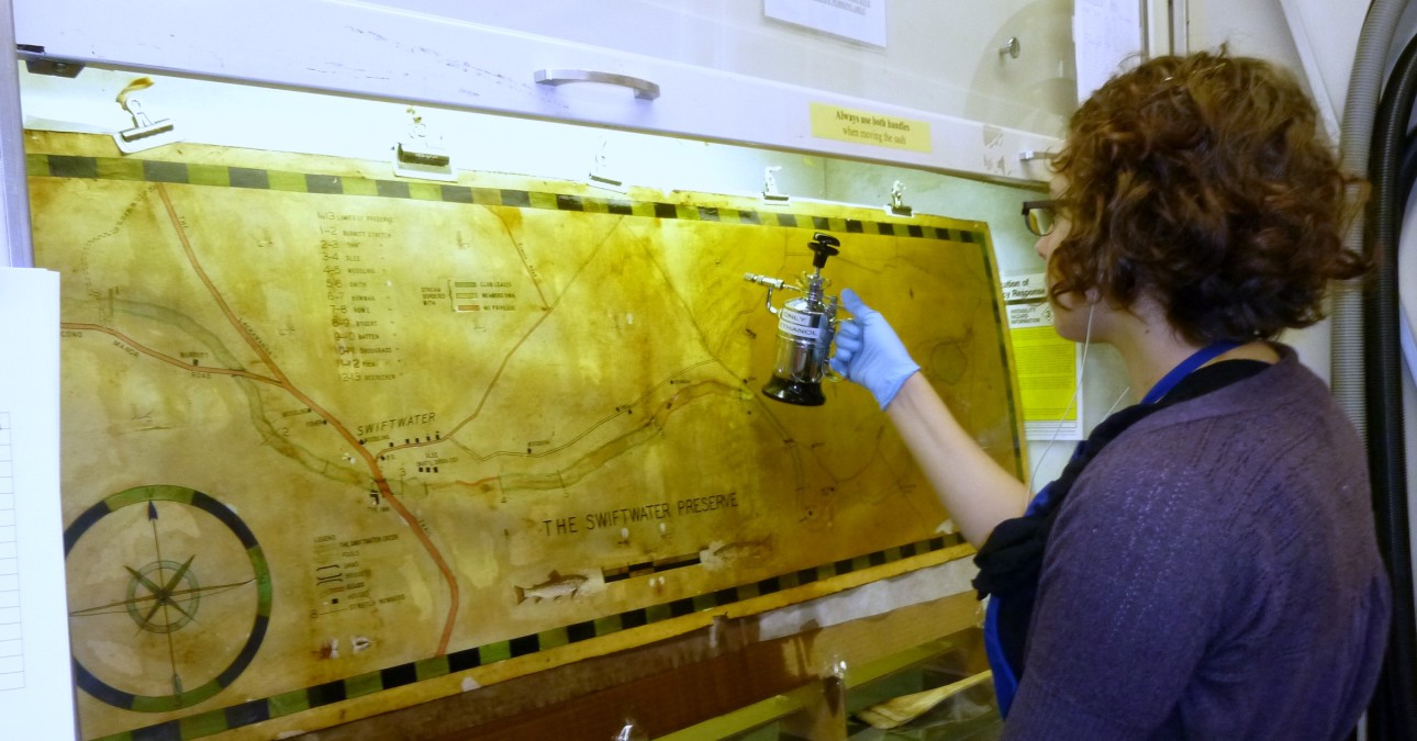
The map was covered with thick, uneven varnish, which over the years had turned the color of dark honey, obscuring details of Craige’s small drawings of fishing lures and changing the map’s colors. The varnish worried Mellon Fellow Jessica Keister, who treated the map, because it contributed to the paper’s brittleness and prevented her from effectively washing it.

Fortunately, the varnish was soluble in ethanol, making it possible to remove it. So much dirt was trapped in the varnish that Jessica felt it would not work to place the map in a flat container of ethanol to reduce varnish, as she usually would. Instead, she built a temporary easel to support the map in an upright position. When Jessica sprayed the map with solvent, the varnish and grime dripped into a tray placed beneath the easel, collecting there instead of sticking to the paper.
After removing the varnish, Jessica blotter washed the map to lessen discoloration and acidity and reduced minor local staining using small amounts of diluted bleach. She lined the back of the map with mulberry paper and filled a loss at the bottom with toned paper before humidifying and flattening the map. Following treatment, Michelle Dauberman, Manager of Digital Documentation, digitally captured the front of the map. Scott reports that the resulting images may be used to produce a limited run of prints for interested Preserve members.
Finally, Jessica Makin, Manager of Housing and Framing, will house the map in a sealed package and frame before it is returned to the Preserve, which will hang the map in its clubhouse, as originally planned.